Yellowstone River Flooding 2022, Project 2

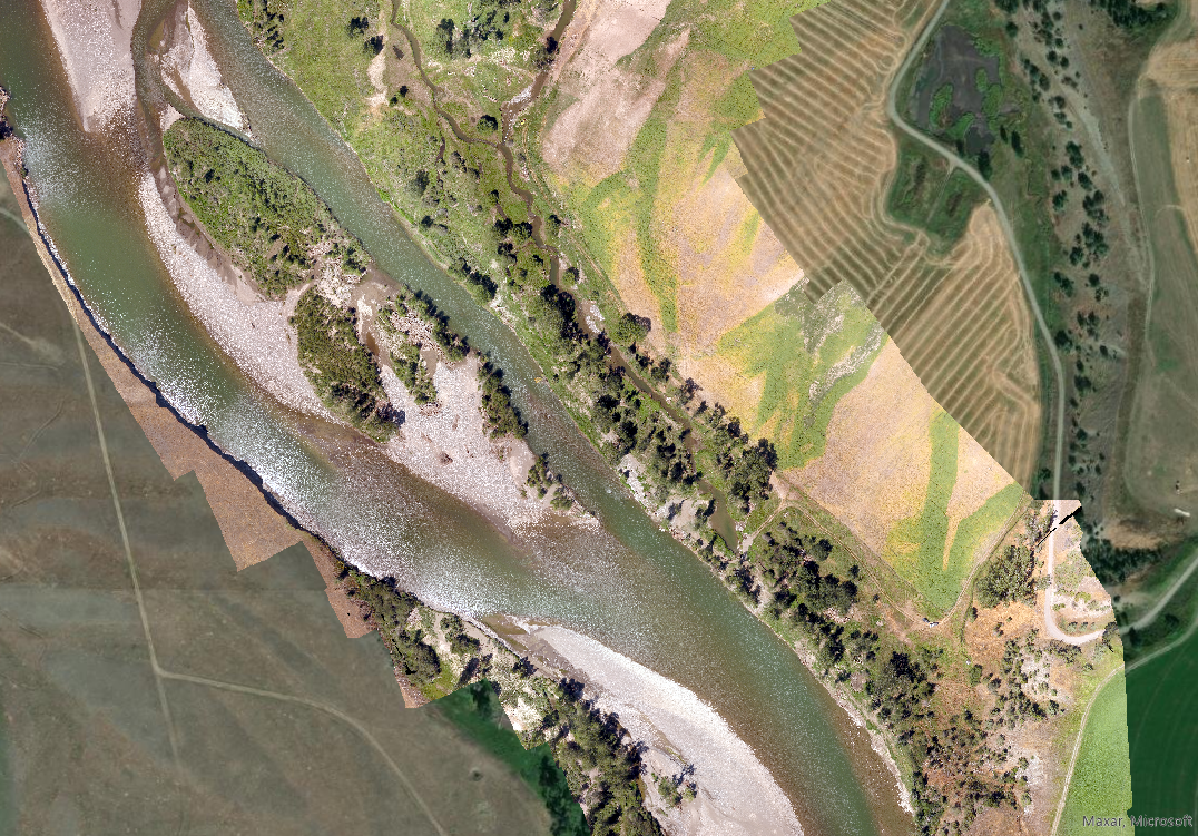
On another project on the Yellowstone River after the historic 2022 floods, Montana Map Works was hired by river restoration engineers to UAS map and video/photo a site for clients who were concerned about damage to a previously restored creek that provided spawning and rearing habitat for trout. Based on UAS models the restored creek fared exceptionally well during the flooding, and helped engineers as well as ranch managers, identify areas of woody debris recruitment/loss and calculate change in land use. Additional unexpected data gathered via UAS was the extreme change in habitat composition on the Yellowstone River itself,